Suite à une grève chez bpost il n'est temporairement pas possible de choisir pour livraison à domicile ou à une autre adresse. Besoin de quelque chose en urgence ? Choissisez pour retrait en magasin ou passez plutôt dans un magasin Club à proximité.
- Retrait gratuit dans votre magasin Club
- 7.000.000 titres dans notre catalogue
- Payer en toute sécurité
- Toujours un magasin près de chez vous
Suite à une grève chez bpost il n'est temporairement pas possible de choisir pour livraison à domicile ou à une autre adresse. Besoin de quelque chose en urgence ? Choissisez pour retrait en magasin ou passez plutôt dans un magasin Club à proximité.
- Retrait gratuit dans votre magasin Club
- 7.000.0000 titres dans notre catalogue
- Payer en toute sécurité
- Toujours un magasin près de chez vous


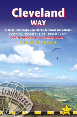
Cleveland Way
British Walking Guide: Planning, Places to Stay, Places to Eat; Includes 48 Large-Scale Walking Maps
Henry Stedman
18,95 €
+ 37 points
Format
Description
A 110-mile National Trail, the Cleveland Way is set in the beautiful wild countryside of the North York Moors National Park. It runs from Helmsley near Thirsk around the western edge of the park to reach the coast at Saltburn-by-the-Sea. It then continues along the eastern edge of the park south down the coast through Whitby, Robin Hood's Bay and Scarborough to finish in Filey. Combining moorland and coast there's wonderful scenic variety to this walk, with crumbling castles and idyllic fishing villages to explore. This is an all-in-one hiking route guide, maps and accommodations for the 110-mile Cleveland Way, set in the North York Moors National Park. Includes 48 large-scale walking maps (3 1/8 inches to 1 mile); 8 town maps and 12 overview maps. Full details of all accommodations and campsites, restaurants and pubs; plus full public transport information. Includes day-walks. - 8 town plans and 48 large-scale walking maps - at just under 1:20,000 - showing route times, places to stay, points of interest and much more- Plus 10 overview mapsItineraries for all walkers - whether walking the route in its entirety over seven to eight days or sampling the highlights on day walks and short breaks- Practical information for all budgets - camping, bunkhouses, hostels, B&Bs, pubs and hotels - where to stay, where to eat, what to see, plus detailed street plans- Comprehensive public transport information - for all access points on the path.Flora and fauna - four page full color flower guide, plus an illustrated section on local wildlife- Green hiking - understanding the local environment and minimizing our impact on it- GPS waypoints. These are also downloadable from the Trailblazer website.- Includes extra colour sections: 16pp colour introduction and 10pp of colour mapping for stage sections (one stage per page) with trail profiles.
Spécifications
Parties prenantes
- Auteur(s) :
- Editeur:
Contenu
- Nombre de pages :
- 208
- Langue:
- Anglais
- Collection :
Caractéristiques
- EAN:
- 9781905864911
- Date de parution :
- 02-07-19
- Format:
- Livre broché
- Format numérique:
- Trade paperback (VS)
- Dimensions :
- 119 mm x 178 mm
- Poids :
- 204 g