Suite à une grève chez bpost il n'est temporairement pas possible de choisir pour livraison à domicile ou à une autre adresse. Besoin de quelque chose en urgence ? Choissisez pour retrait en magasin ou passez plutôt dans un magasin Club à proximité.
- Retrait gratuit dans votre magasin Club
- 7.000.000 titres dans notre catalogue
- Payer en toute sécurité
- Toujours un magasin près de chez vous
Suite à une grève chez bpost il n'est temporairement pas possible de choisir pour livraison à domicile ou à une autre adresse. Besoin de quelque chose en urgence ? Choissisez pour retrait en magasin ou passez plutôt dans un magasin Club à proximité.
- Retrait gratuit dans votre magasin Club
- 7.000.0000 titres dans notre catalogue
- Payer en toute sécurité
- Toujours un magasin près de chez vous


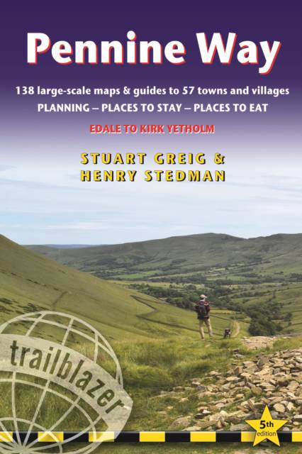
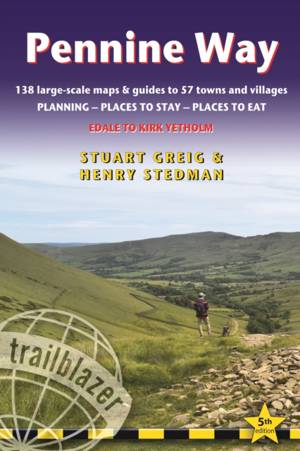
Pennine Way
British Walking Guide: Planning, Places to Stay, Places to Eat; Includes 138 Large-Scale Walking Maps
Stuart Greig, Henry Stedman
19,95 €
+ 39 points
Format
Description
Britain's best-known National Trail winds for 256 miles through three National Parks - the Peak District, Yorkshire Dales and Northumberland. This superb footpath showcases Britain's finest upland scenery, while touching the literary landscape of the Brontë family and Roman history along Hadrian's Wall. This all-in-one hiking route guide, maps and accommodations for the 256-mile Pennine Way, from England into Scotland. Includes 138 large-scale walking maps (3 1/8 inches to 1 mile); 10 town maps and 15 overview maps. Full details of all accommodations and campsites, restaurants and pubs; plus full public transport information. Includes day-walks.- 10 town plans and 138 large-scale walking maps - at just under 1:20,000 - showing route times, places to stay, points of interest and much more- Plus 15 overview maps- Itineraries for all walkers - whether walking the route in its entirety over seven to eight days or sampling the highlights on day walks and short breaks- Practical information for all budgets - camping, bunkhouses, hostels, B&Bs, pubs and hotels - where to stay, where to eat, what to see, plus detailed street plans- Comprehensive public transport information - for all access points on the path.- Flora and fauna - four page full color flower guide, plus an illustrated section on local wildlife- Green hiking - understanding the local environment and minimizing our impact on it- GPS waypoints. These are also downloadable from the Trailblazer website.- Includes extra colour sections: 16pp colour introduction and 16pp of colour mapping for stage sections (one stage per page) with trail profiles.
Spécifications
Parties prenantes
- Auteur(s) :
- Editeur:
Contenu
- Nombre de pages :
- 312
- Langue:
- Anglais
- Collection :
Caractéristiques
- EAN:
- 9781912716029
- Date de parution :
- 02-07-19
- Format:
- Livre broché
- Format numérique:
- Trade paperback (VS)
- Dimensions :
- 142 mm x 181 mm
- Poids :
- 312 g