
- Retrait gratuit dans votre magasin Club
- 7.000.000 titres dans notre catalogue
- Payer en toute sécurité
- Toujours un magasin près de chez vous
- Retrait gratuit dans votre magasin Club
- 7.000.0000 titres dans notre catalogue
- Payer en toute sécurité
- Toujours un magasin près de chez vous


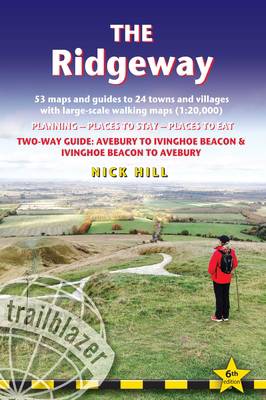
The Ridgeway
Two-Way Guide with 53 Large-Scale Walking Maps (1:20,000) & Guides to 24 Towns & Villages - Planning, Places to Stay, Places to Eat
Nick Hill
21,50 €
+ 43 points
Description
The go-to, all-in-one guide to walking The Ridgeway path. Running from Wiltshire to Buckinghamshire, in southern England, this ancient trackway is Britain's oldest road. In this fully revised and updated, two-way edition all routes have been completely rewalked in both directions from Avebury to Ivinghoe Beacon near Aylesbury and Ivinghoe Beacon to Avebury. Taking 5-7 days, this is not a difficult walk and the rewards are many: rolling countryside, Iron Age forts, Neolithic burial mounds, white horses carved into the chalk downs and picturesque villages. Coverage includes: Marlborough, Avebury, West Overton, Avebury Stone Circle, Kennett and East Kennett, Foxhill, Liddington, Wantage, Bishopstone, Ashbury, Woolstone, Uffington, Goring, Streatley, Wallingford, Crowmarsh Gifford, Watlington, Princes Risborough, Tring, Ivinghoe Beacon In this guide you will find:
- 53 detailed walking maps - the largest scale maps available - at just under 1:20,000 (8cm or 31/8 inches to one mile) these are bigger than even the most detailed walking maps currently available in the shops
- Unique mapping features - walking times, directions, tricky junctions, places to stay, places to eat, points of interest. These are not general-purpose maps but fully edited maps drawn by walkers for walkers
- Itineraries for all walkers - whether hiking the entire route or sampling highlights on day walks or short breaks
- Detailed public transport information for all access points
- Practical information for all budgets - what to see; where to eat (cafes, pubs and restaurants); where to stay (B&Bs, hotels, hostels, bunkhouses and campsites)
- Downloadable GPS waypoints and what3words references
Spécifications
Parties prenantes
- Auteur(s) :
- Editeur:
Contenu
- Nombre de pages :
- 216
- Langue:
- Anglais
- Collection :
Caractéristiques
- EAN:
- 9781912716524
- Date de parution :
- 15-08-25
- Format:
- Livre broché
- Format numérique:
- Trade paperback (VS)
- Dimensions :
- 120 mm x 180 mm
- Poids :
- 127 g

Les avis
Nous publions uniquement les avis qui respectent les conditions requises. Consultez nos conditions pour les avis.