
- Retrait gratuit dans votre magasin Club
- 7.000.000 titres dans notre catalogue
- Payer en toute sécurité
- Toujours un magasin près de chez vous
- Retrait gratuit dans votre magasin Club
- 7.000.0000 titres dans notre catalogue
- Payer en toute sécurité
- Toujours un magasin près de chez vous


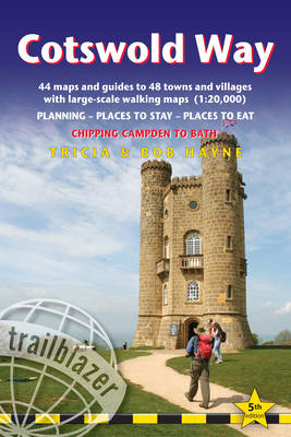
Cotswold Way
British Walking Guide: Planning, Places to Stay, Places to Eat; Includes 44 Large-Scale Walking Maps
Tricia Hayne, Bob Hayne
21,50 €
+ 43 points
Description
All-in-one hiking route guide and maps to the Cotswold Way, a 102-mile National Trail that runs from Chipping Campden to Bath, following the beautiful Cotswold escarpment for most of its course. The trail leads through quintessentially English countryside with little villages of honey-coloured stone to the well-known town of Bath. Includes 44 large-scale maps (3 1/8 inches to 1 mile); 9 town plans and 8 overview maps. Full details of all accommodations and campsites, restaurants and pubs; plus full public transport information. Plus day-walks.
Fully revised and rewalked 5th edition.
- 44 large-scale walking maps - at just under 1:20,000 - showing route times, places to stay, points of interest and much more
- 9 town plans - Chipping Campden, Broadway, Winchcombe, Cheltenham, Painswick, Dursley, Wotton-under-Edge, and the city of Bath
- 8 area maps and trail profiles
- Itineraries for all walkers - whether walking the route in its entirety over seven to eight days or sampling the highlights on day walks and short breaks
- Practical information for all budgets - camping, bunkhouses, hostels, B&Bs, pubs and hotels; Chipping Campden to Bath - where to stay, where to eat, what to see, plus detailed street plans
- Comprehensive public transport information - for all access points on the Cotswold Way.
- Flora and fauna - four page full color flower guide, plus an illustrated section on local wildlife
- Green hiking - understanding the local environment and minimizing our impact on it
- Bath city guide
- Includes downloadable gps waypoints now also with what3words references
Spécifications
Parties prenantes
- Auteur(s) :
- Editeur:
Contenu
- Nombre de pages :
- 204
- Langue:
- Anglais
- Collection :
Caractéristiques
- EAN:
- 9781912716418
- Date de parution :
- 26-05-24
- Format:
- Livre broché
- Format numérique:
- Trade paperback (VS)
- Dimensions :
- 122 mm x 180 mm
- Poids :
- 199 g

Les avis
Nous publions uniquement les avis qui respectent les conditions requises. Consultez nos conditions pour les avis.