
- Retrait gratuit dans votre magasin Club
- 7.000.000 titres dans notre catalogue
- Payer en toute sécurité
- Toujours un magasin près de chez vous
- Retrait gratuit dans votre magasin Club
- 7.000.000 titres dans notre catalogue
- Payer en toute sécurité
- Toujours un magasin près de chez vous


Description
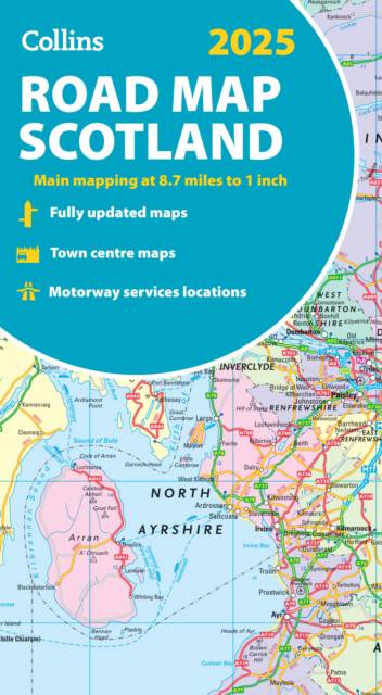
Explore Scotland with easy-to-read mapping from Collins.
Full-color map of Scotland at 8.7 miles to 1 inch, with clear road network and administrative areas shown in color. The map covers the whole of Scotland and part of Northern England conveniently on one side, and is ideal for reference or route planning.
The map shows the road network in detail for easy route planning and has easily identifiable local council areas and boundaries.
The main features of this road map are:
- Fully updated
- Administrative areas shown in color
- Clear, detailed road network and road distances
- Town and city names, rivers, railway lines and canals are clearly shown
- 7 city/town center street plans showing places of interest
- Index to place names
- Mileage chart
- Car ferry routes
- Key in English, French and German
Spécifications
Parties prenantes
- Auteur(s) :
- Editeur:
Contenu
- Nombre de pages :
- 2
- Langue:
- Anglais
- Collection :
Caractéristiques
- EAN:
- 9780008652999
- Date de parution :
- 18-06-24
- Format:
- Carte pliée
- Dimensions :
- 127 mm x 235 mm
- Poids :
- 130 g

