
Suite à une grève chez bpost il n'est temporairement pas possible de choisir pour livraison à domicile ou à une autre adresse. Besoin de quelque chose en urgence ? Choissisez pour retrait en magasin ou passez plutôt dans un magasin Club à proximité.
- Retrait gratuit dans votre magasin Club
- 7.000.000 titres dans notre catalogue
- Payer en toute sécurité
- Toujours un magasin près de chez vous
Suite à une grève chez bpost il n'est temporairement pas possible de choisir pour livraison à domicile ou à une autre adresse. Besoin de quelque chose en urgence ? Choissisez pour retrait en magasin ou passez plutôt dans un magasin Club à proximité.
- Retrait gratuit dans votre magasin Club
- 7.000.0000 titres dans notre catalogue
- Payer en toute sécurité
- Toujours un magasin près de chez vous


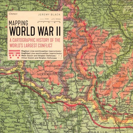
Mapping World War II
A Cartographic History of the World's Largest Conflict
Jeremy Black
Livre relié | Anglais
43,45 €
+ 86 points
Description
Packed with contemporary maps, this is a visual survey of how conflict was recorded and planned before and during World War II, revealing how warfare and its documentation and presentation changed throughout the conflict.
World War II was a global conflict on an unprecedented scale. On land, sea, and in the skies, nations threw everything that they had into the fray in order to achieve victory. This exciting collection of contemporary maps shows in vivid detail the true scope of the conflict, from the Japanese invasion of China in 1937, through the fighting in Europe, North Africa, and the Pacific, all the way up to the end of the conflict. Alongside maps showing how the war was conducted at strategic, operational, and tactical levels, this book contains maps produced for political purposes, including those depicting economic production, social changes such as large-scale evacuations, and those used in the all-important propaganda wars designed to bolster morale and influence public opinion. Following on from his Maps of War and Mapping Naval Warfare, renowned historian Jeremy Black collates a brilliant selection of fascinating maps and shows how they have been used to both illustrate and plan campaigns throughout the conflict.Spécifications
Parties prenantes
- Auteur(s) :
- Editeur:
Contenu
- Nombre de pages :
- 192
- Langue:
- Anglais
Caractéristiques
- EAN:
- 9781472829856
- Date de parution :
- 19-09-23
- Format:
- Livre relié
- Format numérique:
- Genaaid
- Dimensions :
- 280 mm x 280 mm

