- Retrait gratuit dans votre magasin Club
- 7.000.000 titres dans notre catalogue
- Payer en toute sécurité
- Toujours un magasin près de chez vous
- Retrait gratuit dans votre magasin Club
- 7.000.000 titres dans notre catalogue
- Payer en toute sécurité
- Toujours un magasin près de chez vous


Description
- Waterproof - Tear-Resistant - Topographic Map
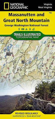
The Lee Ranger District is the northernmost portion of the George Washington National Forest. Only a two-hour drive from Washington, D.C., this area includes portions of the Massanutten and Great North Mountain ranges separated by the historic Shenandoah Valley. Expertly researched and created in partnership with local land management agencies, National Geographic's Trails Illustrated map of Massanutten and Great North Mountain provides an unparalleled tool for making the most of your visit to this scenic region. Key areas of interest featured on this map include Lost River State Park; Raymond R. "Andy" Guest Jr. Shenandoah River State Park; Harrisonburg; Luray; Woodstock; and a portion of Shenandoah National Park.
Designed with a wide range of visitors in mind, this map features an extensive trail chart showing mileage, difficulty rating, blaze, and suitable trail use; a handy activity guide for George Washington National Forest; parking areas suitable for horse trailers; and important trail information. With miles of mapped trails including Massanutten National Recreation Trail and portions of the Appalachian and Tuscarora trails, this map can guide you off the beaten path and back again in some of the most breathtaking scenery in the region. River mileage on a significant portion of the Shenandoah River is noted for those exploring by boat. Recreation features are clearly marked, including campgrounds, trailheads, boat launches, fishing access, swimming areas, and points of interest. The map base includes contour lines and elevations for summits and passes.
Every Trails Illustrated map is printed on "Backcountry Tough" waterproof, tear-resistant paper. A full UTM grid is printed on the map to aid with GPS navigation.
Other features found on this map include: Cove Mountain, George Washington National Forest, Great North Mountain, Massanutten Mountain, Shenandoah, Shenandoah Mountain.
- Map Scale = 1:75,000
- Sheet Size = 25.5" x 37.75"
- Folded Size = 4.25" x 9.25"
Spécifications
Parties prenantes
- Auteur(s) :
- Editeur:
Contenu
- Nombre de pages :
- 2
- Langue:
- Anglais
- Collection :
- Tome:
- n° 792
Caractéristiques
- EAN:
- 9781566953887
- Date de parution :
- 01-04-09
- Format:
- Carte pliée
- Dimensions :
- 102 mm x 229 mm
- Poids :
- 90 g