
- Retrait gratuit dans votre magasin Club
- 7.000.000 titres dans notre catalogue
- Payer en toute sécurité
- Toujours un magasin près de chez vous
- Retrait gratuit dans votre magasin Club
- 7.000.000 titres dans notre catalogue
- Payer en toute sécurité
- Toujours un magasin près de chez vous


Description
- Waterproof - Tear-Resistant - Topographic Map
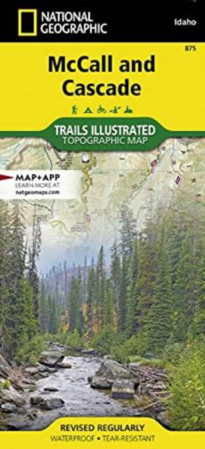
Centered on Payette Lake and the resort town of McCall, the map covers the western half of Payette National Forest and the North Fork Payette River, the northern section of Boise National Forest including Warm Lake and Vulcan Hot Springs, the South Fork Salmon River, and Lake Cascade and the town of Cascade. This mountainous region of lakes, ponds, rivers, streams, wetlands, and wide and narrow valleys features extensive motorized and non-motorized trails and recreation areas for year-round adventures on land, water, and snow, located just over 2 hours from Boise. Opportunities abound for hiking, fishing, camping, hunting, skiing, and snowmobiling across the region's federal and state lands.
Multi-use recreation features on the map include big game management units, ranger district boundaries, research natural areas, wilderness study areas, as well as the boundaries and amenities of state lands including Ponderosa State Park and Lake Cascade State Park. Trails of all types are meticulously mapped, classified, and labeled, including the Lava Ridge National Recreation Trail, a 60-mile section of the Idaho Centennial Trail, and hundreds of miles of groomed winter snowmobile routes. Natural features and landmarks are clearly mapped and labeled, and visitor amenities are shown for all developed camping and recreation sites, including campsite capacities, water put-ins and take-outs, winter activities, hot springs, lookout towers, restrooms, food, gas, lodging, and picnic tables. The map includes the towns of McCall, Cascade, Council, New Meadows, and Donnelly and the historic settlements of Burgdorf Hot Springs, Warren, and Warm Lake, the Brundage Mountain and Tamarack ski resorts, and the north end of the Payette River Scenic Byway.
All trails are marked and labeled with trail mileages and uses, and elevations at junctions, with steep slopes clearly indicated. Road mileages for navigating through the region are also marked and labeled to help estimate travel times. The map margins include fishing, hunting, and motorized vehicle regulations, plus contact information for local, state, and federal land and resource management agencies and Leave No Trace guidelines and ethics.
Every Trails Illustrated map is printed on "Backcountry Tough" waterproof, tear-resistant paper. A full UTM grid is printed on the map to aid with GPS navigation. Every map purchase helps support the National Geographic Society, an impact driven, nonprofit organization with global reach that uses the power of science, exploration, education, and storytelling to illuminate and protect the wonder of our world.
Other features found on this map include: West Mountains, Grass Mountains, Salmon River Mountains, Grass Mountains, Long Valley, Secesh River, Weiser River, French Creek, Little Salmon River, Thunderbolt Mountain, Hard Butte, Lava Butte, Bear Basin, Lava Lakes, Carey Lakes, Crestline Trail.
- Map Scale = 1:75,000
- Sheet Size = 25.5" x 37.75"
- Folded Size = 4.25" x 9.25"
Spécifications
Parties prenantes
- Auteur(s) :
- Editeur:
Contenu
- Nombre de pages :
- 2
- Langue:
- Anglais
- Collection :
- Tome:
- n° 875
Caractéristiques
- EAN:
- 9781566958295
- Date de parution :
- 12-12-22
- Format:
- Carte pliée
- Dimensions :
- 108 mm x 235 mm
- Poids :
- 81 g

