- Retrait gratuit dans votre magasin Club
- 7.000.000 titres dans notre catalogue
- Payer en toute sécurité
- Toujours un magasin près de chez vous
- Retrait gratuit dans votre magasin Club
- 7.000.000 titres dans notre catalogue
- Payer en toute sécurité
- Toujours un magasin près de chez vous


Description
- Waterproof - Tear-Resistant - Topographic Map
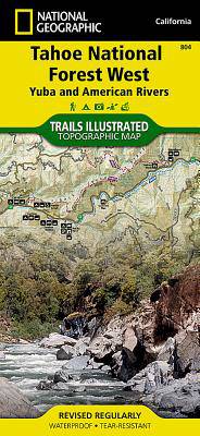
Expertly researched and created in partnership with the U.S. Forest Service and others, National Geographic's Trails Illustrated map of Yuba and American Rivers region of Tahoe National Forest provides an unparalleled tool for exploring this historically significant region of the Sierras. Whatever the season, you'll find this map a useful tool in pursuing a host of recreational activities from skiing and snowmobiling to camping and boating. The map features many key points of interest, including French Meadows and New Bullards Bar Reservoirs, Granite Chief Wilderness, South Yuba River Recreation Area, Malakoff Diggins State Historic Park, Donner Memorial State Park and the western rim of the Lake Tahoe Basin Management Unit.
The Tahoe National Forest West map can guide you off the beaten path and back again with miles of clearly marked trails including portions of the Pacific Crest, Pioneer, and Tahoe Rim trails. To help you choose the path that's right for you, trails are color coded according to the designated usage and mileage between intersections is indicated. The Yuba Donner scenic byways is noted for those wishing to take in the scenery by car. Many recreation features are noted as well, including ski areas, campgrounds, trailheads, wildlife viewing areas, boat launches, and swimming and fishing areas. The map base includes contour lines and elevations for summits, passes and many lakes.
Every Trails Illustrated map is printed on "Backcountry Tough" waterproof, tear-resistant paper. A full UTM grid is printed on the map to aid with GPS navigation.
Other features found on this map include: Donner Pass, Eldorado National Forest, Granite Chief Wilderness, Mosquito Ridge, Plumas National Forest, Sawtooth Ridge, Tahoe National Forest, Truckee.
- Map Scale = 1:63,360
- Sheet Size = 25.5" x 37.75"
- Folded Size = 4.25" x 9.25"
Spécifications
Parties prenantes
- Auteur(s) :
- Editeur:
Contenu
- Nombre de pages :
- 2
- Langue:
- Anglais
- Collection :
Caractéristiques
- EAN:
- 9781566954259
- Date de parution :
- 01-01-06
- Format:
- Carte pliée
- Format numérique:
- Gelamineerd
- Dimensions :
- 10 cm x 19 cm
- Poids :
- 91 g