Suite à une grève chez bpost il n'est temporairement pas possible de choisir pour livraison à domicile ou à une autre adresse. Besoin de quelque chose en urgence ? Choissisez pour retrait en magasin ou passez plutôt dans un magasin Club à proximité.
- Retrait gratuit dans votre magasin Club
- 7.000.000 titres dans notre catalogue
- Payer en toute sécurité
- Toujours un magasin près de chez vous
Suite à une grève chez bpost il n'est temporairement pas possible de choisir pour livraison à domicile ou à une autre adresse. Besoin de quelque chose en urgence ? Choissisez pour retrait en magasin ou passez plutôt dans un magasin Club à proximité.
- Retrait gratuit dans votre magasin Club
- 7.000.0000 titres dans notre catalogue
- Payer en toute sécurité
- Toujours un magasin près de chez vous


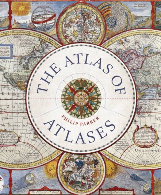
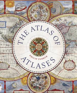
Atlas of Atlases
Exploring the Most Important Atlases in History and the Cartographers Who Made Them
Philip Parker
32,95 €
+ 65 points
Description
This beatutiful book is a lavishly illustrated look at the most important atlases in history and the cartographers who made them. Atlases are books that changed the course of history. Pored over by rulers, explorers, and adventures these books were used to build empires, wage wars, encourage diplomacy, and nurture trade. Written by Philip Parker, an authority on the history of maps, this book brings these fascinating artefacts to life, offering a unique, lavishly illustrated guide to the history of these incredible books and the cartographers behind them. All key cartographic works from the last half-millennium are covered, including:
- The Theatrum Orbis Terrarum, considered the world's first atlas and produced in 1570 by the Dutch, geographer Abraham Ortelius,
- The 17th-century Klencke -- one of the world's largest books that requires 6 people to carry it,
- The Rand McNally Atlas of 1881, still in print today and a book that turned its makers, William H Rand and Andrew McNally into cartographic royalty.
Spécifications
Parties prenantes
- Auteur(s) :
- Editeur:
Contenu
- Nombre de pages :
- 272
- Langue:
- Anglais
- Collection :
Caractéristiques
- EAN:
- 9780711268050
- Date de parution :
- 25-10-22
- Format:
- Livre relié
- Format numérique:
- Genaaid
- Dimensions :
- 206 mm x 239 mm
- Poids :
- 1202 g