- Retrait gratuit dans votre magasin Club
- 7.000.000 titres dans notre catalogue
- Payer en toute sécurité
- Toujours un magasin près de chez vous
- Retrait gratuit dans votre magasin Club
- 7.000.000 titres dans notre catalogue
- Payer en toute sécurité
- Toujours un magasin près de chez vous


Description
- Waterproof - Tear-Resistant - Travel Map
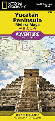
Home to historic Maya civilization as well as to many of Mexico's most beautiful beaches, the Yucatan Peninsula is a popular tourist destination. National Geographic's Yucatan Peninsula Adventure Map is a complete travel guide to the region. Coverage begins in the area of Campeche and continues to the Caribbean Sea and Gulf of Mexico shorelines, including the Riviera Maya. The front side presents hundreds of points of interest, a detailed road network and topographic features, combined in one expertly researched map, along with inset maps of the cities Merida and Cancun. While the reverse side provides maps and valuable information of the Maya ruins at Chichen Itza, Ek Balam, Tulum, San Gervasio, Coba, El Rey and Uxmal.
A user-friendly index of federal, state and municipal protected areas, such as Isla Mujeres, Yum Balam and Cozumel, will help you find your adventure site. Then, plan your route with the mapped road network which includes major roads as well as dirt and gravel roads, for those wishing to travel off the beaten path. Additional transportation features mapped include airstrips, ferry routes. railroads and harbors. Along the way, find cultural, historical, ecological and adventure points of interest, such as UNESCO World Heritage Sites, Maya sites, ruins, lighthouses, beaches, reefs and areas for surfing, kayaking, sailing, wind surfing, snorkeling, diving and fishing.
Every Adventure Map is printed on durable synthetic paper, making them waterproof, tear-resistant and tough -- capable of withstanding the rigors of international travel.
- Map Scale = 1:500,000
- Sheet Size = 37.75" x 25.5"
- Folded Size = 4.25" x 9.25"
Spécifications
Parties prenantes
- Auteur(s) :
- Editeur:
Contenu
- Nombre de pages :
- 2
- Langue:
- Anglais
- Collection :
Caractéristiques
- EAN:
- 9781566952453
- Date de parution :
- 01-05-22
- Format:
- Carte pliée
- Format numérique:
- Gelamineerd
- Dimensions :
- 11 cm x 24 cm
- Poids :
- 96 g